Shad restoration efforts are underway in numerous rivers and streams along the East Coast of the U.S. A 1985 study titled “A Review and Recommendations Relating to Fishways Within the Delaware Basin” commissioned by the Delaware Basin Fish and Wildlife Management Cooperative identified three tributaries historically used by shad for spawning which had “the greatest potential for restoration.” These include the Lehigh, the Schuylkill, and the Brandywine Rivers.
Both the short and long-term activities to restore shad migration to the Brandywine envisioned by the Brandywine River Restoration Trust builds on — and is carefully guided by — numerous engineering and environmental studies, historic and cultural impact considerations, comparative cost estimates, and the initial restoration projects completed over the past two decades.
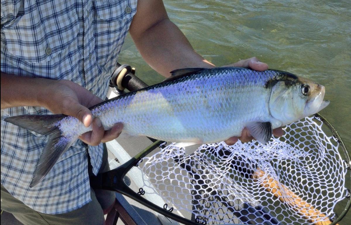
American Shad caught on the Schuylkill River near Philadelphia, Pennsylvania
Guided by Science
2005: The Brandywine Conservancy conducted an initial river reconnaissance and explored the feasibility of restoring the American Shad to the Brandywine by enabling passage past 11 dams in Delaware that have impeded their ancestral spawning since the colonial days. Results of their analysis indicated there are technically and economically feasible options for providing fish passage at all of these dams. The Conservancy concluded that a variety of methods could potentially be employed, including fish ladders, rock ramps, by-pass channels, or dam removals. VIEW REPORT
2015: The Water Resource Center of the University of Delaware utilized information from the 1985 Delaware agency study (mentioned above) to estimate the cumulative shad potential which could be gained by providing fish passage through the Brandywine River dams in Delaware. That report also provided information regarding dam location, owner, owner of land on east and west bank, historic and present function, approximate height and width and other structural characteristics of the dam sites. VIEW REPORT
2022: In their final report to the National Fish and Wildlife Foundation, The Nature Conservancy published “Restoration Roadmap for American Shad, Alewife, and Blueback Herring” in the Delaware River Basin. The Restoration Roadmap outlines a basin-wide strategy for reconnecting historic and high-quality habitats. Their study identified the Brandywine River as one of the Tier 1, highest-priority waterways within the Delaware River Basin for restoration. VIEW REPORT
2022: The University of Delaware’s Center for Historic Architecture and Design conducted National Register of Historic Places eligibility evaluations in the Area of Potential Effects (APE) for the provision of fish passage at dams 2 through 6 on the Delaware section of the Brandywine River. VIEW REPORT
Our Goal
The most important goal shared by Brandywine River Restoration Trust and their partners is to restore the region’s most historic fish, the American Shad, to the Brandywine. Creating fish passage requires that each dam be studied individually to determine the best solution. Sometimes it is not possible to remove a dam, such as the case with Dam 2 which supplies water to the City of Wilmington, and the dams within the Hagley Museum and Library which are within a National Historic Landmark District. In these cases, alternatives are developed such as fish ladders, rock ramps or natural by-passes.
This unique approach has the potential to be the nation’s most ambitious fish passage project (by number of dams) across a single watershed.
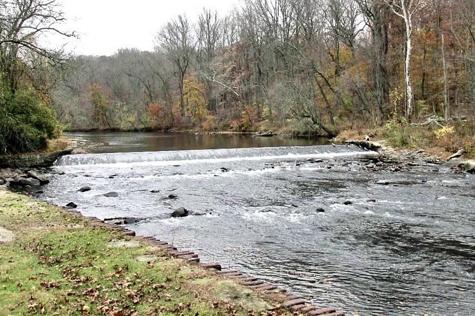
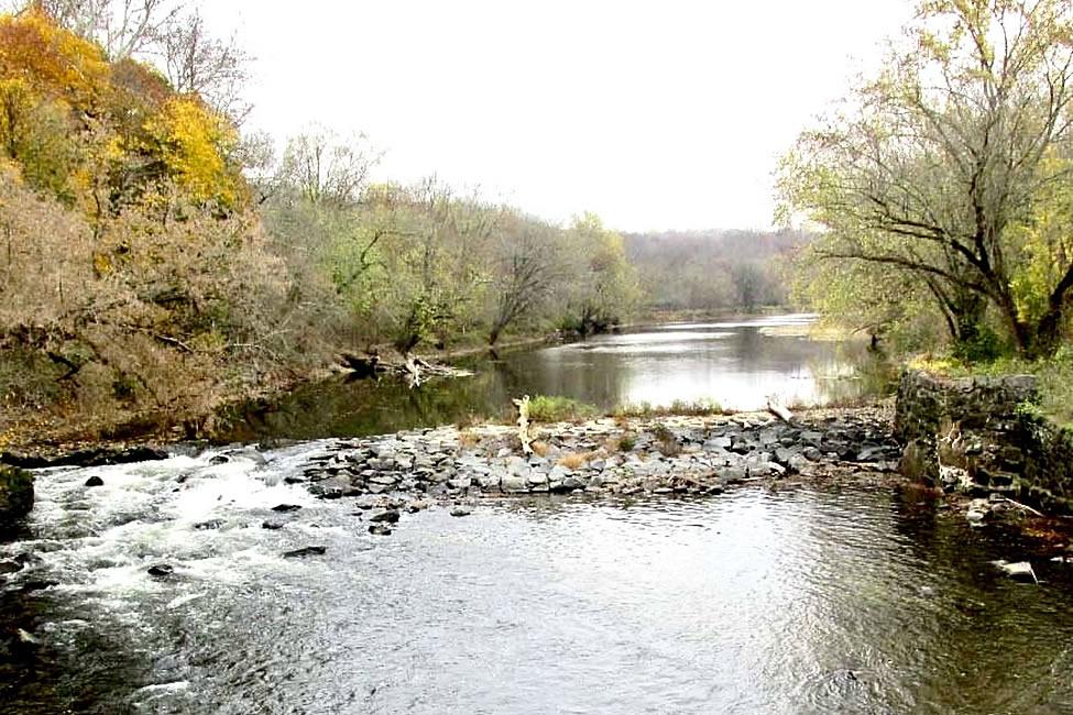
The Delaware Dams
Dam removal is one proven technique for restoring fish migration, as shown by the University of Delaware’s White Clay Creek project in 2014. The remains of a Revolutionary War-era dam was removed, resulting in shad now moving 4-5 miles upstream toward Newark in initially small but growing numbers.
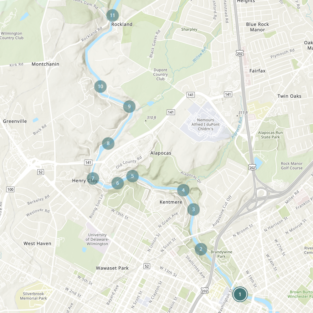
All 11 of Delaware’s Brandywine dams are concentrated on the river between river miles 2.1 and 7.2. They are considered small dams; none is higher than 10-foot tall, and five are in the 2 to 4-foot range. This should simplify fish passage design, and reduce implementation costs.
The dams remaining in Delaware are numbered 2 through 11, moving upstream from downtown Wilmington, north past the Hagley Museum to Rockland.
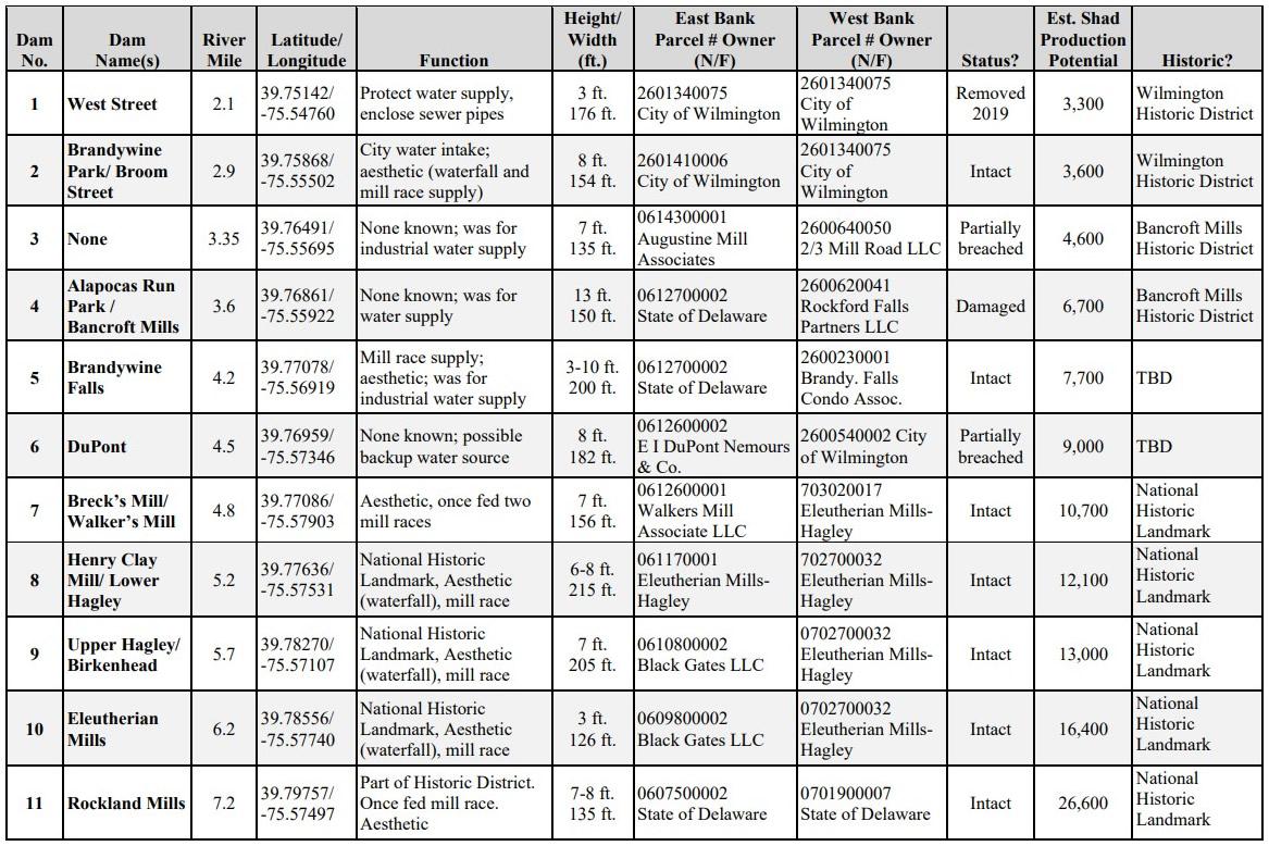
Dam 2 | Broom Street
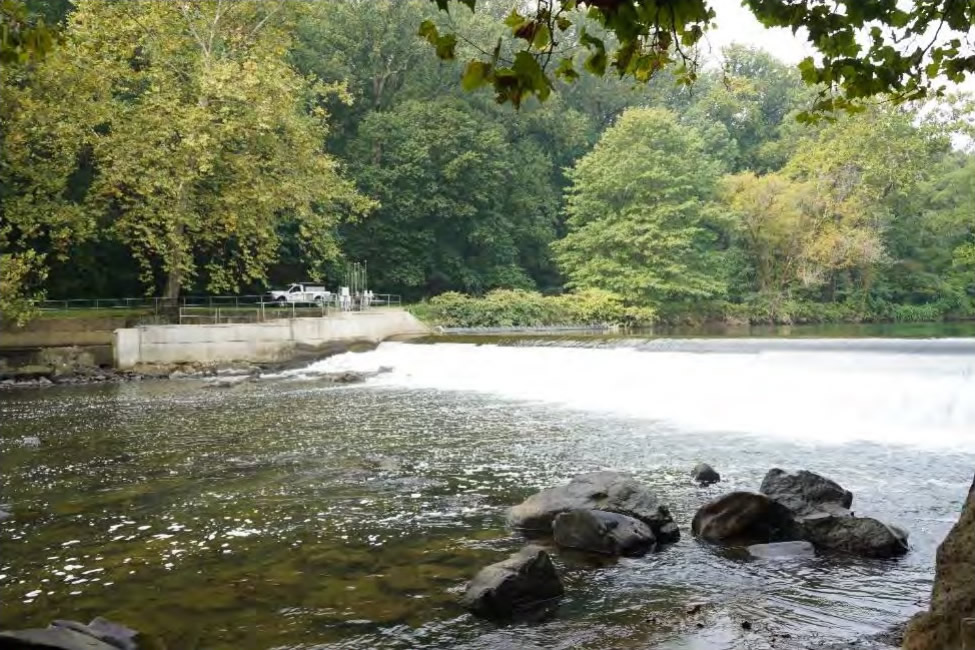
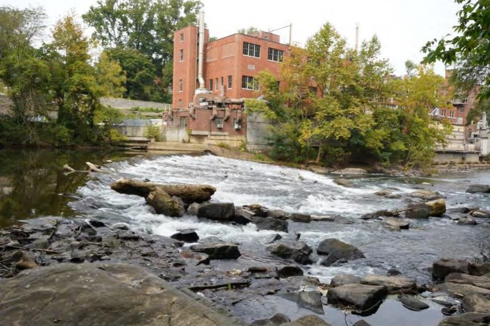
Dam 2 is an approximately 8-foot-tall, 176-foot-wide granite block dam. It located at river mile 2.9, within Brandywine Park. Brandywine Park is a state park managed by the Delaware Department of Natural Resources and Environmental Controls (DNREC). It is referred to by several names, including the Brandywine Park Dam, Broom Street Dam, and City Dam. The dam serves as a central part of the City of Wilmington’s water supply. Water is diverted into the mill race, on river right, which connects to the City’s treatment plant. The City of Wilmington owns this dam.
Dam 3 | Augustine Mill
Dam 3 is an approximately 6-foot-tall, 135-foot-wide dam located at river mile 3.35. The land at the west abutment of the dam is owned by 2/3 Mill Road, LLC. The land at the east abutment of the dam is owned by the Augustine Mill Associates. Historically the dam was used for industrial water supply, but there is no current use. No mill race survives in its current state, although there is a historic channel on river left behind the existing masonry wall. Brandywine Conservancy’s 2005 report noted the dam as being breached; the deterioration appears to have continued to since then.
Dam 4 | Bancroft Mills
Dam 4 is an approximately 13-foot-tall, 150-foot-wide dam located at river mile 3.6. It is referred to as the Alapocas Run Park or Bancroft Mills Dam. Land at the west abutment is owned by the Rockford Mills Partners; the east abutment is owned by the State of Delaware. Historically the dam was used for water supply, but there is no current use. There is no surviving mill race. There is an existing fishway that was constructed in the 1970s, but has not been operated or maintained since the 1980s. A sanitary sewer owned by New Castle County is on the left shore. A section of the dam appears to be undermined.
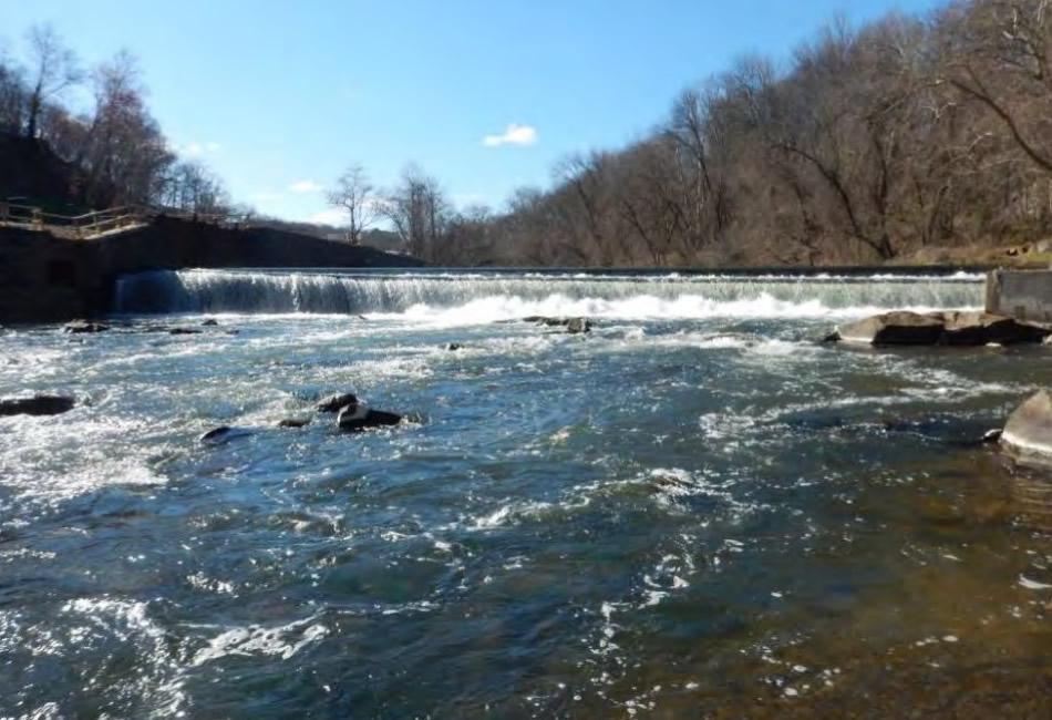
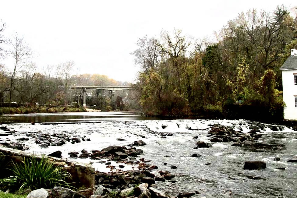
Dam 5 | Brandywine Falls
Dam 5 is approximately 3-10 feet tall, 200-foot-wide, located a river mile 4.2. The dam is owned by the City of Wilmington and the State of Delaware. This is one of the tallest dams on the lower Brandywine, built on top of a large rock outcropping on river left. The mill race remains, on river right, with a small amount of water trickling through the metal headgate. Historically the water diverted by this dam was utilized by the textile industry. The dam is no longer utilized beyond minimal flow into the mill race.
Dam 6 | Experimental Station
Dam 6 is approximately 8-foot tall, 182-foot-wide, located at River Mile 4.5. It is referred to as both the DuPont Experimental Station and the Rockford Park Dam. The land at the west abutment is owned by the City of Wilmington; the east abutment is owned by the E.I. DuPont Nemours & Co. The dam was once used for water supply by DuPont; the water intake has since been sealed up. No mill race exists. The dam is partially breached, with damage to the apron. A county-owned concrete sewer line crosses the river just downstream of the dam, which protrudes from the bottom and creates a barrier to fish passage at lower flows.
Dam 7 | Breck's & Walker's Mill
Dam 7 is approximately 6-foot tall, located between Breck’s Mill and Walker’s Mill within the Henry Clay Village Historic District at river mile 4.8. The land on the west bank of the dam is owned by Eleutherian Mills-Hagley Foundation; the east bank owner is the Walkers Mill Association LLC. Dam 7 historically fed two mill races, which remain with the dam currently. Due to its historic significance, the dam will not be removed and alternative means for enabling fish passage will be developed.
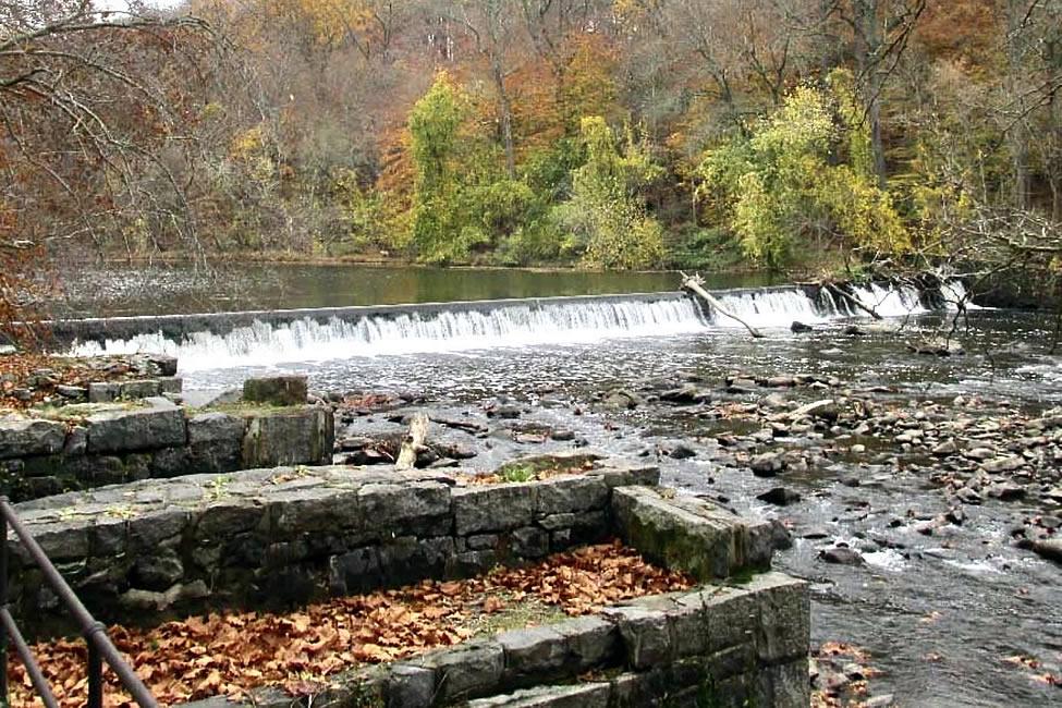
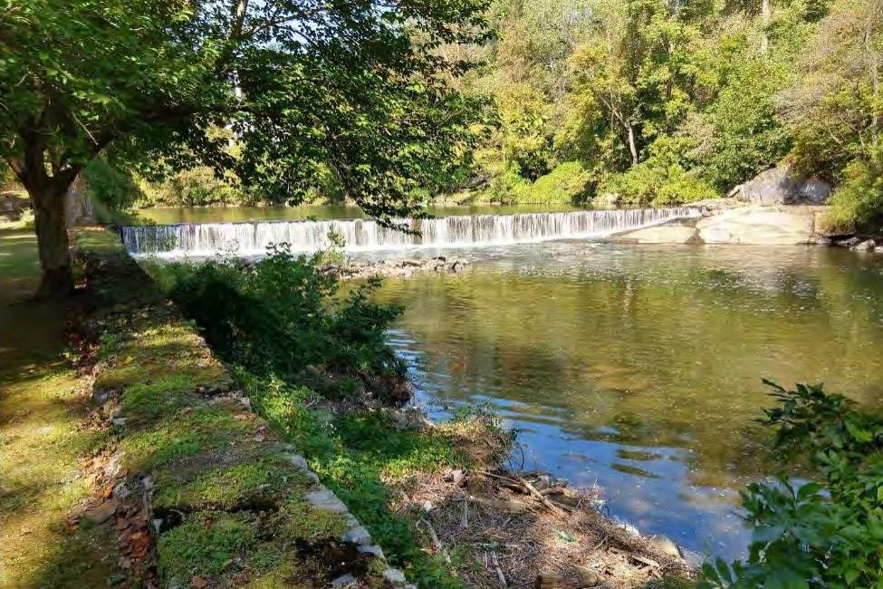
Dam 8 | Lower Hagley
Dam 8 is approximately 6 to 8-foot tall, located at river mile 5.2 near Henry Clay Mill. The land on both the east and west banks is owned by the Eleutherian Mills-Hagley Foundation. Dam 8 historically fed a mill race, which currently survives with the dam. Dam 8 is a historical dam within the Hagley Museum grounds.
This dam is the visual centerpiece of the Hagley Museum main visitor entrance, and feeds a lower mill race running past several old gun powder mills. The grounds and facilities here are part of the Brandywine Powder Mills Historic District, a subset of which is the Eleutherian Mills Historic District. Due its historic significance, the dam will not be removed and alternate means to enable fish passage will be developed.
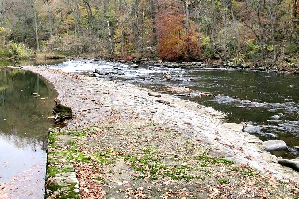
Dam 9 | Upper Hagley
Dam 9 is approximately 2-foot high, located at river mile 5.7, near Birkenhead Mill. The Eleutherian Mills-Hagley Foundation owns the land on the west bank, and the east bank is owned by Black Gates LLC. Dam 9 historically fed a mill race, which currently survives with the dam.
Dam 9 is a historical dam within the Hagley Museum grounds, and a contributing factor to the Brandywine Powder Mills National Historic District. This dam diverts water into an adjacent mill race and is used to power small scale turbines that provide power to museum exhibits and demonstrations, including the museum’s modern electric shuttle. Due to its historic significance, the dam will not be removed and alternate means to enable fish passage will be developed.
Dam 10 | Eleutherian Mills
Dam 10 is approximately 3-foot high, located at river mile 6.2, near Eleutherian Mills. The Eleutherian Mills-Hagley Foundation owns the land on the west bank, and the east bank by Black Gates LLC. Dam 10 historically fed a mill race, which currently survives with the dam. The dam today diverts water into two raceways on both sides of the river.
The original dam, built around 1800, was critical to the du Pont family’s production of gun powder throughout the 19th and early 20th centuries. Dam 10 is a contributing factor to the Brandywine Powder Mills National Historic District. Due its historic significance, the dam will not be removed and alternate means to enable fish passage will be developed.
Dam 11 | Rockland Mills
Dam 11 is approximately 7 to 8-foot high, located at river mile 7.2, near Rockland Mills. The land on both the east and west banks is owned by the State of Delaware. Dam 11 historically fed a mill race, which currently survives with the dam. Dam 11 is part of the Rockland Mills Historic District.
The dam developed a small breach which increased in size and flow over the winter of 2003-04 on the river right side of the dam, opposite the mill race.